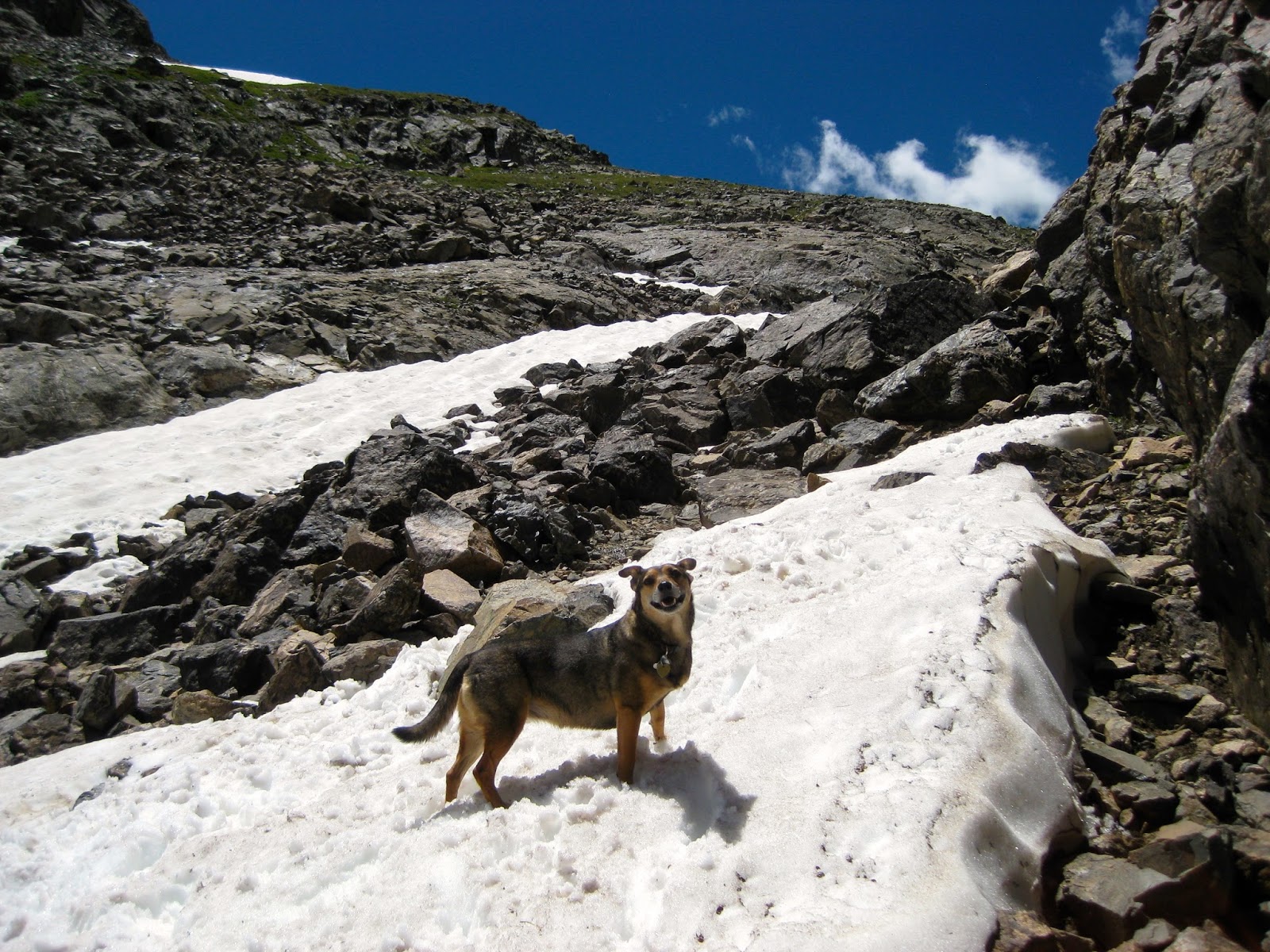
The second day, we hiked up and over a pass that provided immensely stunning views of the surrounding mountains. We watched a huge herd of elk climb a nearby pass and drop down the other side. We took our time walking through fields of wildflowers before dropping down the pass into Capitol Lake. After lunch, we made it out the Capitol Ditch Trail and up to Hell Roaring; we ended up stopping at Hardscrabble Lake for the night. We had the lake all to ourselves, and Loki was fascinated by jumping fish all evening long.
Showing posts with label backpacking. Show all posts
Wednesday, August 3, 2016
Avalanche - Capitol - Hell Roaring
After scouring the maps for nearby loop hikes, I found a fun opportunity to hike 30 miles and explore some terrain close to home. We hiked up Avalanche Creek to Avalanche Lake and camped for a night, which was a beautiful and challenging 11 miles for our first day.
The second day, we hiked up and over a pass that provided immensely stunning views of the surrounding mountains. We watched a huge herd of elk climb a nearby pass and drop down the other side. We took our time walking through fields of wildflowers before dropping down the pass into Capitol Lake. After lunch, we made it out the Capitol Ditch Trail and up to Hell Roaring; we ended up stopping at Hardscrabble Lake for the night. We had the lake all to ourselves, and Loki was fascinated by jumping fish all evening long.
The final day we hiked to Williams Lake then up to the Divide, which gave us a unique view of Mount Sopris. We lost the trail just over the pass, went the wrong way down and were forced to complete several grueling miles bushwacking before reconnecting with the trail at a lower point. Hell Roaring Trail is steep! We were glad to be hiking down this trail and not up.
It was a great trip, and rounded out 100 miles of backpacking for the summer of 2016.
The second day, we hiked up and over a pass that provided immensely stunning views of the surrounding mountains. We watched a huge herd of elk climb a nearby pass and drop down the other side. We took our time walking through fields of wildflowers before dropping down the pass into Capitol Lake. After lunch, we made it out the Capitol Ditch Trail and up to Hell Roaring; we ended up stopping at Hardscrabble Lake for the night. We had the lake all to ourselves, and Loki was fascinated by jumping fish all evening long.
Saturday, July 23, 2016
Mount Whitney
Six ridiculous chicks refusing to take anything too seriously on a mission to bring a bit of Colorado to California, conquering the tallest peak in the lower 48 while learning how to use wag bags, helping strangers in need, and making plenty of new friends along the way.
Sometimes you're in the exact right place with the exact right people, and beautiful memories are made. As they say, the magic is in the journey - not the destination. While in this case there was magic in everything. From buying ridiculous cat shirts at Walmart to nearly dying while driving through Death Valley to watching incredible strength at the finish line of the Badwater Ultramarathon to blowing bubbles on top of the world - the whole trip was a sparkling treasure that I will keep forever.
Thursday, July 14, 2016
Conundrum Hot Springs
Conundrum Hot Springs: a magical place overrun by partying backpackers.
What an incredibly stunning, picturesque, unique treasure that is currently trashed. We must have passed one hundred people - give or take - hiking out as we were hiking in. And I feel I should mention this was on a Thursday. We timed it right though, and had the hot spring to ourselves for almost an hour in the middle of the day during the transition of hikers departing and arriving.
As night fell, every campsite in the vicinity filled up, as did the hot springs. Hopefully we can all learn to take care of the magical natural places that we love to visit and spend time in.
Monday, July 4, 2016
Four Pass Loop
Ahh, the iconic Four Pass Loop! We set out to complete this 26 mile loop in 3 days, beginning at the Maroon Bells and hiking counter-clockwise over all four picturesque passes. While backpacking breathes an air of solitude, the Four Pass Loop surely did not. It is one of the most popular magical places I've backpacked in.
The trip seemed a lost cause when I woke up ill the night before our departure. It delayed our start significantly; however, by 11:00am we were hiking up toward Buckskin Pass in a misty drizzle before finding a campsite nestled in some trees just below the pass. We didn't make it far that first day, but listening to the rain hit the tent fly as afternoon turned into night was both healing and rejuvenating.
Each day thereafter consisted of snow crossings, pass climbing and a lot of rain. The low clouds blocked the views of distant peaks, but they cloaked the passes and meadows in still, quiet, eerie mystery.
On our last day, we awoke to blue skies. We welcomed the change in weather and as the sun recharged us, we made our way over West Maroon Pass - the final pass of the trip.
The trip seemed a lost cause when I woke up ill the night before our departure. It delayed our start significantly; however, by 11:00am we were hiking up toward Buckskin Pass in a misty drizzle before finding a campsite nestled in some trees just below the pass. We didn't make it far that first day, but listening to the rain hit the tent fly as afternoon turned into night was both healing and rejuvenating.
Each day thereafter consisted of snow crossings, pass climbing and a lot of rain. The low clouds blocked the views of distant peaks, but they cloaked the passes and meadows in still, quiet, eerie mystery.
On our last day, we awoke to blue skies. We welcomed the change in weather and as the sun recharged us, we made our way over West Maroon Pass - the final pass of the trip.
Monday, June 20, 2016
West Elk Loop
Setting off on the first backpack trip of the season, we made our way up Kebler Pass to Horse Park (Cliff Creek Trail) and began our hike into the West Elk Wilderness. The trail was beautiful right off the bat, and we were greeted by some beautiful grazing deer. We made good time to Beckwith Pass, where we took a break to soak up the views. Four people on horseback passed us here on their way to Beckwith Bench, which sounds like a great hike, too.
After our break, we continued on toward Cliff Creek Trail. At some point, we lost the trail completely and found ourselves on a game trail. After much consultation with the compass, map and GPS, we discovered we were below the trail; we hike straight up what felt like a mountain and were relieved to reconnect with the trail. The trail was very muddy in spots, allowing and severely highlighting animal tracks. I kept finding bear tracks, and I began to get nervous. Around 5:30, we were pulling into the area we wanted to camp in, and, as I rounded the corner I heard two loud grunty, breathy, deep snorts or barks from the bushes. I hollered ahead to Justin, who came back, but thought maybe it was just a deer bounding away.
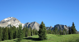
I had a sinking feeling that those snorts came from a bear, however. We began to set up camp in a beautiful meadow and cook dinner. Just as dinner was ready, I looked up, and saw a bear. The bear was about a hundred yards away, he was, grazing and sniffing the air while, all the while, watching us. This was my first real encounter with a bear, so naturally, I overreacted. I watched in a panic for close to an hour as the bear lingered beyond our camp. As the sun began to set, the bear sauntered off in the opposite direction of us, but I decided we just couldn't sleep there. We packed everything up, and hiked about another mile before setting up our tent in the dark. I didn't get much sleep that night.
The next morning, we hiked up to Sheep Lake, an out-and-back trail off of our loop. We spent some time at the lake snacking and filling water, before realizing we still had 6 miles to hike that day. We didn't realize two of those six would be through snowfields. We connected in with the Castle Pass Trail, which had some truly amazing views, and began our track up to the highest point of our trip, 11,000 feet. We anticipated some snow, but what we found was certainly more than we were hoping for. Justin post-holed us a trail for nearly two miles through deep snowfields. He was determined to make it over Castle Pass.
Our feet were sopping wet by the time we made it over the pass, and we were relieved to be heading back down into lower elevation. The views of the Castles from the other side of the pass were magnificent. We made it into a beautiful basin, and decided to set up camp for the night.
On our last day, we hiked up and over Swampy Pass and back over Beckwith Pass before descending back to Kebler Pass. Overall, the trip was 29 miles long with roughly 5000 feet of elevation gain. The path we took was from Horse Ranch Park (Cliff Creek Trail) to Beckwith Pass to Cliff Creek Trail to Castle Pass to Lowline Trail back to Beckwith. I highly recommend the trip as an early or late season backpack, as I hear it is a popular grazing area for livestock in the summer months.
After our break, we continued on toward Cliff Creek Trail. At some point, we lost the trail completely and found ourselves on a game trail. After much consultation with the compass, map and GPS, we discovered we were below the trail; we hike straight up what felt like a mountain and were relieved to reconnect with the trail. The trail was very muddy in spots, allowing and severely highlighting animal tracks. I kept finding bear tracks, and I began to get nervous. Around 5:30, we were pulling into the area we wanted to camp in, and, as I rounded the corner I heard two loud grunty, breathy, deep snorts or barks from the bushes. I hollered ahead to Justin, who came back, but thought maybe it was just a deer bounding away.
I had a sinking feeling that those snorts came from a bear, however. We began to set up camp in a beautiful meadow and cook dinner. Just as dinner was ready, I looked up, and saw a bear. The bear was about a hundred yards away, he was, grazing and sniffing the air while, all the while, watching us. This was my first real encounter with a bear, so naturally, I overreacted. I watched in a panic for close to an hour as the bear lingered beyond our camp. As the sun began to set, the bear sauntered off in the opposite direction of us, but I decided we just couldn't sleep there. We packed everything up, and hiked about another mile before setting up our tent in the dark. I didn't get much sleep that night.
The next morning, we hiked up to Sheep Lake, an out-and-back trail off of our loop. We spent some time at the lake snacking and filling water, before realizing we still had 6 miles to hike that day. We didn't realize two of those six would be through snowfields. We connected in with the Castle Pass Trail, which had some truly amazing views, and began our track up to the highest point of our trip, 11,000 feet. We anticipated some snow, but what we found was certainly more than we were hoping for. Justin post-holed us a trail for nearly two miles through deep snowfields. He was determined to make it over Castle Pass.
Our feet were sopping wet by the time we made it over the pass, and we were relieved to be heading back down into lower elevation. The views of the Castles from the other side of the pass were magnificent. We made it into a beautiful basin, and decided to set up camp for the night.
On our last day, we hiked up and over Swampy Pass and back over Beckwith Pass before descending back to Kebler Pass. Overall, the trip was 29 miles long with roughly 5000 feet of elevation gain. The path we took was from Horse Ranch Park (Cliff Creek Trail) to Beckwith Pass to Cliff Creek Trail to Castle Pass to Lowline Trail back to Beckwith. I highly recommend the trip as an early or late season backpack, as I hear it is a popular grazing area for livestock in the summer months.
Sunday, July 26, 2015
Fancy Pass Loop
"I'm so fancy!"
I woke up one summer morning in July and realized I had yet to put my backpack on this season. Knowing that had to change, I immediately began planning for an adventure.
After some time spent reading guidebooks and looking at maps, I settled on Fancy Pass Loop, also known as Missouri Lakes Loop. The trip is eight miles long with two passes, Fancy Pass and Missouri Pass. Once I decided this was the spot, I scoured the web looking for trip reports and such.
I quickly discovered that this is one of the more popular loops in the Holy Cross Wilderness. Website after website warned against overuse and crowded trails. I had already planned everything out; however, so I decided to give it a try anyways.
My husband had the grand idea to hike up Fancy Pass and down Missouri Pass, which turned out to be an excellent decision as most people seemed to day hike to Missouri Lakes. We hardly saw a soul until we reached Fancy Lake, and even then we only crossed paths with two other groups.
Fancy Lake is stunning, but Fancy Pass is daunting with a 35 pound pack and a surprising amount of snow. We took our time crossing snow fields and navigating a path to the top of the pass. The views were beautiful, and we scoped out an area to camp in near Treasure Vault Lake. Several other groups were camping in-between the passes, but the area was large enough that every group was able to find a secluded spot.
We toasted to adventure and enjoyed a dinner of couscous with bacon and veggies while soaking in the views. We had a family dance party in an alpine meadow at sunset, then we went to bed. The following day, we quickly climbed to the top of Missouri Pass and made our way down to the many lakes below.
It turns out the trail wasn't overly crowded, and the mosquitos were more obnoxious than any person we encountered. Happy trails!
After some time spent reading guidebooks and looking at maps, I settled on Fancy Pass Loop, also known as Missouri Lakes Loop. The trip is eight miles long with two passes, Fancy Pass and Missouri Pass. Once I decided this was the spot, I scoured the web looking for trip reports and such.
I quickly discovered that this is one of the more popular loops in the Holy Cross Wilderness. Website after website warned against overuse and crowded trails. I had already planned everything out; however, so I decided to give it a try anyways.
My husband had the grand idea to hike up Fancy Pass and down Missouri Pass, which turned out to be an excellent decision as most people seemed to day hike to Missouri Lakes. We hardly saw a soul until we reached Fancy Lake, and even then we only crossed paths with two other groups.
Fancy Lake is stunning, but Fancy Pass is daunting with a 35 pound pack and a surprising amount of snow. We took our time crossing snow fields and navigating a path to the top of the pass. The views were beautiful, and we scoped out an area to camp in near Treasure Vault Lake. Several other groups were camping in-between the passes, but the area was large enough that every group was able to find a secluded spot.
We toasted to adventure and enjoyed a dinner of couscous with bacon and veggies while soaking in the views. We had a family dance party in an alpine meadow at sunset, then we went to bed. The following day, we quickly climbed to the top of Missouri Pass and made our way down to the many lakes below.
It turns out the trail wasn't overly crowded, and the mosquitos were more obnoxious than any person we encountered. Happy trails!
Labels:
backpack,
backpacking,
camping,
camping with dogs,
colorado,
dogs,
Fancy Pass,
Fancy Pass Loop,
hiking with dogs,
Holy Cross Wilderness,
Missouri Lakes,
Missouri Lakes Loop,
pass,
Treasure Vault Lake
Friday, July 25, 2014
CDT: Elbert to Hagerman Pass
"In every walk with nature one receives far more than he seeks." - John Muir
My husband's sister, Shannon, set out to hike a section of the Continental Divide Trail in Colorado this summer, and she asked my husband and I to meet her in Twin Lakes towards the end of her trip and hike the last four days with her. The section we were asked to hike consisted of summiting Colorado's two tallest peaks, Elbert and Massive!
We met Shannon around noon in Twin Lakes and drove up to the Mount Elbert Trailhead where we spent the night. In the morning, we woke up early and began our hike up Mount Elbert. For a Monday there was a surprising number of hikers on the trail. We summited around 11:00 am, and took a few pictures. It was a cold and windy day, but we were thankful for a clear sky as we made our decent and camped another night in the van.
The next morning we hiked seven miles on the CDT to the intersection of the Mount Massive trail where we made camp for the night. This section of the CDT overlaps with the more popular Colorado Trail, and we saw a ton of other backpackers. We also encountered many day hikers; the most memorable of which was a self proclaimed "experienced hiker" from Boulder asking, "Do I sound okay to you?" from where he sat off the side of the trail, about 2 miles from the parking lot. This day hiker was completely out of food and water; Shannon gave him the last 3/4 liter of water she had along with a pack of fruit snacks, a granola bar and a baggie of nuts. The hiker drank some water and began eating the fruit snacks. He called us angels as we traveled on.
We got a late start on Wednesday morning, beginning our hike up Mount Massive at nearly 7:00 am. I was nervous about the late start, but tried my best to move at a fast (for me) pace up the mountain. We were about a mile and a half from the summit when some clouds began moving in, but we continued up anyway. We made good time to the ridge line and were on the summit before we knew it. And what a spectacular summit it was! It is rocky and harsh and exactly what the top of a mountain should be.
I was elated to have summited Mount Massive, but I knew we needed to begin our journey back down as the storm clouds were moving in, and I never like to be on a fourteener summit after noon. We snapped several photos then began hiking back down and were surprised by just how quickly the afternoon storm moved in. It started with a sprinkle, then turned to heavy rain and finally decided to hail! We were literally jogging down the mountain to find safety and shelter in the trees below.
Once we were out of harm's way, we hiked further down the trail and again setup camp for the night. Thursday was our last day on the trail, and we hiked 9 miles on the CDT to Hagerman Pass Road. We made it to the road in just under 5 hours, and hitched a ride to Justin and Shannon's aunt's house in Leadville.
The trip was wonderful, although tiring, and it definitely satiated my itch for more fourteener summits and backpacking!
Labels:
backpack,
backpacking,
camping,
CDT,
colorado,
Continental Divide Trail,
fourteener,
hagerman pass road,
hail,
hike,
Leadville,
Mount Elbert,
Mount Massive,
mountains,
storm,
Twin Lakes
Monday, June 16, 2014
Erickson Springs to Silver Creek
An all girls backpacking trip had been in the works for some time, and we all got two weekdays off of work in hopes of hiking up to Conundrum Hot Springs - just outside Aspen for a night. Upon researching trail conditions; however, we learned there was still a lot of snow on the last two miles of the trail. So we all put our heads together and came up with a Plan B, which turned out to be hiking a section of the Dark Canyon Trail from Erickson Springs Campground to Silver Creek.
None of us knew much about this trail, nor had any of us hiked in the Raggeds Wilderness before. The section of Dark Canyon we chose to hike was about 6.5 miles each direction, and included the daunting Devil's Stairway. We begun our hike around 9:30 am under a grey sky that continued to threaten us with a storm all day long.
The trail's namesake soon made itself known as the dark canyon walls surrounding Anthrocite Creek shot up into the sky. We quickly found ourselves bushwhacking through overgrown foliage that had sprawled across the trail this Spring. As we popped out of the dense foliage, we came across an abundance of wildflowers including: columbine, lupine, wild roses, indian paintbrush and more.
We reached the Devil's Stairway just after noon and, slowly but surely, began making our ascent up a seemingly never-ending series of steep switchbacks. We had heard rumors in guidebooks and online blogs that the Devil's Stairway wasn't nearly as bad as it's name suggested, but I'm here to tell you that you shouldn't believe everything you read online! That 3/4 mile was tough, indeed! We were all pretty tired when we made it to the top.
At the top of the Devil's Stairway there's a junction in the trail wherein a weathered, less than helpful sign attempts to point out directions and trails. There didn't seem to be much of a defined trail in any direction here, and the sign seemed to be pointing in the wrong direction altogether. We consulted with the map and a compass briefly before heading off in, what we decided was, the direction of Silver Creek. Our confidence and spirits were boosted when it appeared we had made the right decision and were on a defined trail yet again!
We made our way through a dense aspen forest and across a field before the trail took us down to Silver Creek. We set up camp on the bank of Silver Creek and celebrated with wine, of course!
The next day, we broke camp and headed out around 10:30 am. We made good time despite our encounter with an angry, territorial Grouse. Overall it was a great trip, and I look forward to finding solitude and adventure in the Raggeds Wilderness again in the future!
Monday, June 9, 2014
Avalanche Creek to East Fork
Avalanche Creek Trail is located just outside Carbondale, CO and is the perfect early season backpack trip as the trailhead begins at only 7,310 feet, and there are plenty of camping options along the way.
The trail is super popular, but we lucked out on our hike in seeing only one jogger about 5 miles into the wilderness. The jogger let us know that he had run into snow several miles past Duley Park (our camping destination). We knew there was going to be snow, and actually were surprised to find there wasn't as much snow as we thought there would be.
We hiked another half mile to Duley Park before dropping our packs and having lunch. After lunch we decided to hike up to East Fork. We quickly found that the trail past Duley Park was rather poorly maintained as we hopped logs and fallen trees. We crossed a couple of snow patches, none of them were too large, and made it to East Fork rather quickly. After exploring a bit further, we decided to turn around.
We headed back to Duley Park, where we camped for the night and set up our tent just in time for an afternoon shower. Luckily the storm moved out just as quickly as it moved in, so we didn't have to hunker down in the tent long.
It was the perfect first trip of the season, and it has us eagerly anticipating many more backpacking adventures in the high country this summer.
Tuesday, July 23, 2013
Lost Man Loop
The Lost Man Loop is a popular trail up Independence Pass. Don't let the name fool you, however, the trail is not a true loop; my husband and I dropped a car off at the Lost Man trailhead before continuing on in one car to Linkins Lake trailhead where we began our hike. I've heard of other people who hitchhike between the two trailheads instead of driving two vehicles.
In any event, Lost Man Loop in July is spectacular! We took a brief detour in the beginning of our hike to check out Linkins Lake. I'd highly recommend this short detour, because the small lake is absolutely beautiful!
Once back on the main trail we followed the Roaring Fork up to it's headwaters, Independence Lake. We paused there for a snack and then began our hike up the pass and over to Lost Man Lake. Lost Man Lake offers dramatic views and is breathtaking when seen from the top of the pass. Don't forget to look back for an equally incredible view of Independence Lake as well.
We took another break at Lost Man Lake sunning on a rock while eating our lunch. Beyond Lost Man Lake the loop trail continues into a meadow; it then curves with the valley and heads down into marshy wetland. We made camp about 4.5 miles from the trailhead and settled in enjoying fields of wildflowers and the setting sun.
Deer were grazing nearby our camp site all night long making it hard for our dog Rio to get any rest. As the sun came up, we sipped on coffee and packed up our things. The remainder of the hike out to the Lost Man trailhead seemed long and mostly downhill; we began to pass more and more people as we made our way closer to the trailhead and ultimately right past Lost Man Reservoir.
It's always wonderful to get out and enjoy the high country during the summer months, and Independence Pass offers easy access, for sure!
In any event, Lost Man Loop in July is spectacular! We took a brief detour in the beginning of our hike to check out Linkins Lake. I'd highly recommend this short detour, because the small lake is absolutely beautiful!
Once back on the main trail we followed the Roaring Fork up to it's headwaters, Independence Lake. We paused there for a snack and then began our hike up the pass and over to Lost Man Lake. Lost Man Lake offers dramatic views and is breathtaking when seen from the top of the pass. Don't forget to look back for an equally incredible view of Independence Lake as well.
Deer were grazing nearby our camp site all night long making it hard for our dog Rio to get any rest. As the sun came up, we sipped on coffee and packed up our things. The remainder of the hike out to the Lost Man trailhead seemed long and mostly downhill; we began to pass more and more people as we made our way closer to the trailhead and ultimately right past Lost Man Reservoir.
It's always wonderful to get out and enjoy the high country during the summer months, and Independence Pass offers easy access, for sure!
Labels:
aspen,
backpack,
backpacking,
CO,
hike,
hiking,
Independence Lake,
independence pass,
Linkins Lake,
Linkins Lake Trail,
Lost Man,
Lost Man Lake,
Lost Man Loop,
Lost Man Trail,
Roaring Fork
Subscribe to:
Posts (Atom)