Showing posts with label mountains. Show all posts
Sunday, December 20, 2015
Andrew's Lake
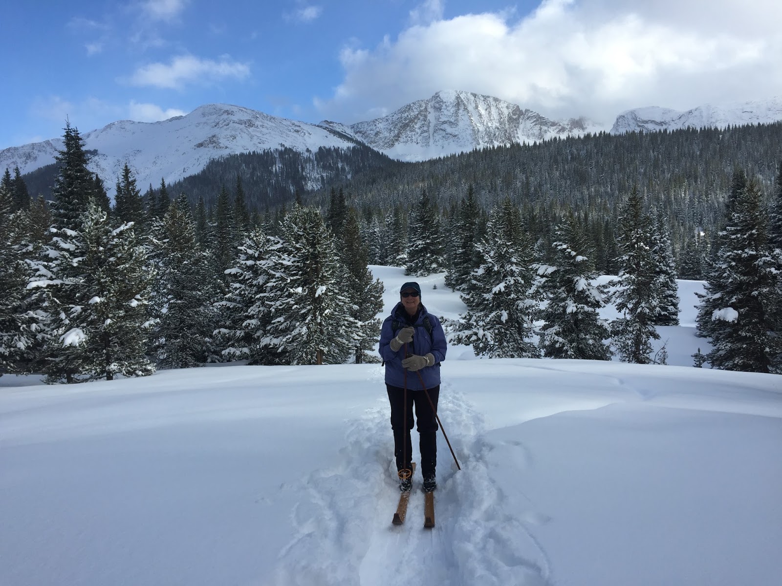
Finding powder in an old stomping ground always puts a smile on my face. To me, Andrew's Lake between Durango and Silverton is one of my favorite places, and certainly one of those important places. Just like the poem that was written from a father to a son in 1986:
Friday, July 25, 2014
CDT: Elbert to Hagerman Pass
"In every walk with nature one receives far more than he seeks." - John Muir
My husband's sister, Shannon, set out to hike a section of the Continental Divide Trail in Colorado this summer, and she asked my husband and I to meet her in Twin Lakes towards the end of her trip and hike the last four days with her. The section we were asked to hike consisted of summiting Colorado's two tallest peaks, Elbert and Massive!
We met Shannon around noon in Twin Lakes and drove up to the Mount Elbert Trailhead where we spent the night. In the morning, we woke up early and began our hike up Mount Elbert. For a Monday there was a surprising number of hikers on the trail. We summited around 11:00 am, and took a few pictures. It was a cold and windy day, but we were thankful for a clear sky as we made our decent and camped another night in the van.
The next morning we hiked seven miles on the CDT to the intersection of the Mount Massive trail where we made camp for the night. This section of the CDT overlaps with the more popular Colorado Trail, and we saw a ton of other backpackers. We also encountered many day hikers; the most memorable of which was a self proclaimed "experienced hiker" from Boulder asking, "Do I sound okay to you?" from where he sat off the side of the trail, about 2 miles from the parking lot. This day hiker was completely out of food and water; Shannon gave him the last 3/4 liter of water she had along with a pack of fruit snacks, a granola bar and a baggie of nuts. The hiker drank some water and began eating the fruit snacks. He called us angels as we traveled on.
We got a late start on Wednesday morning, beginning our hike up Mount Massive at nearly 7:00 am. I was nervous about the late start, but tried my best to move at a fast (for me) pace up the mountain. We were about a mile and a half from the summit when some clouds began moving in, but we continued up anyway. We made good time to the ridge line and were on the summit before we knew it. And what a spectacular summit it was! It is rocky and harsh and exactly what the top of a mountain should be.
I was elated to have summited Mount Massive, but I knew we needed to begin our journey back down as the storm clouds were moving in, and I never like to be on a fourteener summit after noon. We snapped several photos then began hiking back down and were surprised by just how quickly the afternoon storm moved in. It started with a sprinkle, then turned to heavy rain and finally decided to hail! We were literally jogging down the mountain to find safety and shelter in the trees below.
Once we were out of harm's way, we hiked further down the trail and again setup camp for the night. Thursday was our last day on the trail, and we hiked 9 miles on the CDT to Hagerman Pass Road. We made it to the road in just under 5 hours, and hitched a ride to Justin and Shannon's aunt's house in Leadville.
The trip was wonderful, although tiring, and it definitely satiated my itch for more fourteener summits and backpacking!
Labels:
backpack,
backpacking,
camping,
CDT,
colorado,
Continental Divide Trail,
fourteener,
hagerman pass road,
hail,
hike,
Leadville,
Mount Elbert,
Mount Massive,
mountains,
storm,
Twin Lakes
Thursday, July 17, 2014
Cross Mountain Loop
Lizard Head Wilderness can be accessed between Telluride and Rico, CO. I can't tell you how many times I've driven by without stopping; I decided it was finally time (long past time, really) to explore. After doing some research, we decided on hiking the Cross Mountain Loop, which takes you from Cross Mountain Trail to Lizard Head Trail.
It's not a traditional loop as the trailheads are two miles apart. We had two cars, conveniently, and were able to park a car at Lizard Head Trailhead and shuttle our group up to Cross Mountain Trailhead. If you don't have two cars, you'll have to walk parallel to the road for an extra 2 miles once you pop out at Lizard Head Trailhead.
Cross Mountain Trail is rather steep, and we found ourselves above tree-line before we knew it. Well, our lungs and legs definitely knew it and felt it! The Cross Mountain Trail takes you up the face of Black Mountain at the base of Lizard Head Peak before connecting with Lizard Head Trail. We went right on Lizard Head Trail and walked around the base of Lizard Head Peak and then dove back down into the trees.
The trail quickly climbs back out of the trees and up onto the ridge of another mountain. The 360 degree views from the highest point of this trail, an unnamed knob, are phenomenal, and provided a dramatic backdrop for our beef jerky and granola bar lunch.
After the knob, the trail winds down the mountain with the help of TOO MANY switchbacks. We tried to keep count, but gave up around 20. We popped out at the Lizard Head Trailhead around 1:30 pm, just as the afternoon clouds were rolling in.
The Cross Mountain Loop was a great taste of the Lizard Head Wilderness, which boasts miles and miles of pristine, seldom traveled wilderness; I plan on backpacking there in the years to come. Until then...
It's not a traditional loop as the trailheads are two miles apart. We had two cars, conveniently, and were able to park a car at Lizard Head Trailhead and shuttle our group up to Cross Mountain Trailhead. If you don't have two cars, you'll have to walk parallel to the road for an extra 2 miles once you pop out at Lizard Head Trailhead.
Cross Mountain Trail is rather steep, and we found ourselves above tree-line before we knew it. Well, our lungs and legs definitely knew it and felt it! The Cross Mountain Trail takes you up the face of Black Mountain at the base of Lizard Head Peak before connecting with Lizard Head Trail. We went right on Lizard Head Trail and walked around the base of Lizard Head Peak and then dove back down into the trees.
The trail quickly climbs back out of the trees and up onto the ridge of another mountain. The 360 degree views from the highest point of this trail, an unnamed knob, are phenomenal, and provided a dramatic backdrop for our beef jerky and granola bar lunch.
After the knob, the trail winds down the mountain with the help of TOO MANY switchbacks. We tried to keep count, but gave up around 20. We popped out at the Lizard Head Trailhead around 1:30 pm, just as the afternoon clouds were rolling in.
The Cross Mountain Loop was a great taste of the Lizard Head Wilderness, which boasts miles and miles of pristine, seldom traveled wilderness; I plan on backpacking there in the years to come. Until then...
Labels:
black face mountain,
colorado,
Cross Mountain Loop,
Cross Mountain Trail,
high country,
hike,
hiking,
Lizard Head Trail,
Lizard Head Wilderness,
mountains,
Rico,
telluride,
wildflowers,
wilson range
Monday, July 14, 2014
Blue Lake, Telluride
Blue Lake is a must-see for any outdoor enthusiast who stops over in Telluride. It's a stunning, picturesque lake tucked into the high country. The hike starts on top of Bridal Veil Falls, the road to the trailhead requires a truck, SUV or another vehicle with a bit more gusto (and clearance) than a Toyota, Corolla.
Luckily you can park at the bottom of the road, if necessary, and walk or hitchhike up to the trailhead. The trail itself follows an old mining road and weaves it's way into the high country. We unknowingly took a detour, which lengthened our hike substantially, but turned out to be spectacular with lush green mountains, waterfalls and fields of wildflowers.
We made it to the lake around noon, and were quite impressed with the incredible color of the water. The old buildings nearby and the rusty metal mining equipment show the area's rich history, and gave me the opportunity to get extra artsy while photographing the lake!
I'll definitely be returning to Blue Lake in the future. In the meantime though, I'm off to find adventure elsewhere!
We made it to the lake around noon, and were quite impressed with the incredible color of the water. The old buildings nearby and the rusty metal mining equipment show the area's rich history, and gave me the opportunity to get extra artsy while photographing the lake!
I'll definitely be returning to Blue Lake in the future. In the meantime though, I'm off to find adventure elsewhere!
Monday, June 9, 2014
Avalanche Creek to East Fork
Avalanche Creek Trail is located just outside Carbondale, CO and is the perfect early season backpack trip as the trailhead begins at only 7,310 feet, and there are plenty of camping options along the way.
The trail is super popular, but we lucked out on our hike in seeing only one jogger about 5 miles into the wilderness. The jogger let us know that he had run into snow several miles past Duley Park (our camping destination). We knew there was going to be snow, and actually were surprised to find there wasn't as much snow as we thought there would be.
We hiked another half mile to Duley Park before dropping our packs and having lunch. After lunch we decided to hike up to East Fork. We quickly found that the trail past Duley Park was rather poorly maintained as we hopped logs and fallen trees. We crossed a couple of snow patches, none of them were too large, and made it to East Fork rather quickly. After exploring a bit further, we decided to turn around.
We headed back to Duley Park, where we camped for the night and set up our tent just in time for an afternoon shower. Luckily the storm moved out just as quickly as it moved in, so we didn't have to hunker down in the tent long.
It was the perfect first trip of the season, and it has us eagerly anticipating many more backpacking adventures in the high country this summer.
Thursday, September 5, 2013
Hanging Lake
Hanging Lake is one of Glenwood Canyon's most popular hikes and destinations. People from across the country - and across the world, surprisingly - make sure to hike Hanging Lake when they're in the area. And let me be the first to tell you: they're in the area, a lot!!
If you've ever hiked Hanging Lake in the summer or fall, you know just how crowded it can get. The parking lot tends to fill up before noon and, often times, you end up hiking the trail to Hanging Lake with 100 of your closest friends. If you want to forgo the crowds and find a bit more solitude on your nature walk I suggest being on the trail early, around 6:00 or 7:00am. Chances are still slim that you'll be completely alone, but you'll likely miss out on the general over-crowding that occurs by noon everyday.
I've now hiked the Hanging Lake Trail three times: once at the end of November 2012 (it snowed), once in January 2013 (we snowshoed up) and most recently in September 2013. My sister was in town visiting, and visitors always want to hike Hanging Lake.
We arrived at the parking lot at 9:00am and easily found a parking spot, which was a relief. We walked down the bike path to the trailhead and began our hike upwards. Believe me when I say it's a rather difficult uphill climb. Don't be fooled by the low mileage - the trail itself is only slightly over a mile each way; however, be prepared for that mile to sufficiently kick your butt!
The official Glenwood Springs website explains of Hanging Lake, "Geologically speaking, there are few places in the world that can compare to this marvel of Mother Nature. Hanging Lake is a rare example of a lake formed by travertine deposition where the natural geologic and hydro-logic processes continue to operate as they have done throughout the history of the lake. The site is also noteworthy for its thriving hanging garden plant community. Because of these qualities Hanging Lake was designated a National natural Landmark by the Secretary of the Interior in 2011."
Don't forget to take the short detour up to Spouting Rock just above and to the left of Hanging Lake. The beautiful waterfall shooting out from the canyon wall is simply put: not to be missed. You won't regret the short trek up to Spouting Rock, trust me on this one.
The Hanging Lake trail-head is located approximately 10 miles east of Glenwood Springs along Interstate-70 in Glenwood Canyon.
If you've ever hiked Hanging Lake in the summer or fall, you know just how crowded it can get. The parking lot tends to fill up before noon and, often times, you end up hiking the trail to Hanging Lake with 100 of your closest friends. If you want to forgo the crowds and find a bit more solitude on your nature walk I suggest being on the trail early, around 6:00 or 7:00am. Chances are still slim that you'll be completely alone, but you'll likely miss out on the general over-crowding that occurs by noon everyday.
I've now hiked the Hanging Lake Trail three times: once at the end of November 2012 (it snowed), once in January 2013 (we snowshoed up) and most recently in September 2013. My sister was in town visiting, and visitors always want to hike Hanging Lake.
We arrived at the parking lot at 9:00am and easily found a parking spot, which was a relief. We walked down the bike path to the trailhead and began our hike upwards. Believe me when I say it's a rather difficult uphill climb. Don't be fooled by the low mileage - the trail itself is only slightly over a mile each way; however, be prepared for that mile to sufficiently kick your butt!
The official Glenwood Springs website explains of Hanging Lake, "Geologically speaking, there are few places in the world that can compare to this marvel of Mother Nature. Hanging Lake is a rare example of a lake formed by travertine deposition where the natural geologic and hydro-logic processes continue to operate as they have done throughout the history of the lake. The site is also noteworthy for its thriving hanging garden plant community. Because of these qualities Hanging Lake was designated a National natural Landmark by the Secretary of the Interior in 2011."
Don't forget to take the short detour up to Spouting Rock just above and to the left of Hanging Lake. The beautiful waterfall shooting out from the canyon wall is simply put: not to be missed. You won't regret the short trek up to Spouting Rock, trust me on this one.
The Hanging Lake trail-head is located approximately 10 miles east of Glenwood Springs along Interstate-70 in Glenwood Canyon.
Subscribe to:
Posts (Atom)